

The underground quarries beneath the Catacombs
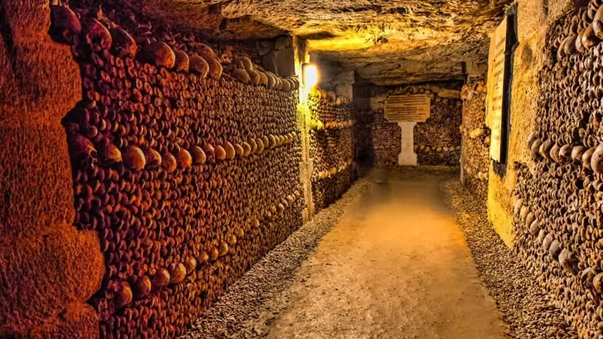
The official Catacombs ossuary is only a small, secured section of a far larger network of former limestone quarries running to roughly 200–300km beneath Paris. Cutting this stone to build the city above caused street collapses through the 18th century, prompting the creation of the Inspection Générale des Carrières in 1777 to map and shore up the tunnels. Almost all of the wider network remains permanently off-limits to the public.
Walk the 1.5km visitor route through the ossuary and you’re seeing a fraction of what actually lies beneath the streets of Paris. The tunnels you pass through were never dug to hold bones — they’re the leftovers of centuries of stone quarrying, and the ossuary was simply built into a small, convenient corner of a network that spreads for hundreds of kilometres under the Left Bank.
This guide explains where that wider network came from, why it nearly brought Paris’s streets crashing down, and how the official Catacombs came to occupy just one secured pocket of it.
The Paris Quarries at a Glance
| Detail | Fact |
|---|---|
| Stone quarried | Lutetian limestone |
| Total tunnel network | Roughly 200–300km, mostly under the Left Bank |
| Official body created to manage it | Inspection Générale des Carrières (1777) |
| Official Catacombs visitor route | About 1.5km — a small, secured fraction of the network |
| Public access to the wider network | Not permitted; almost all of it is closed and unlit |
How big is the quarry network beneath Paris?
Estimates put the former quarry network beneath Paris at roughly 200–300km of galleries, concentrated under the 5th, 6th, 13th, 14th and 15th arrondissements on the Left Bank. That dwarfs the official Catacombs, whose ossuary and visitor route cover only about 1.5km. The rest is unlit, only partially mapped, and closed to the public.
The exact figure varies between sources, since large stretches were filled in, collapsed, or lost from official maps over the centuries, and surveying is still incomplete in places. What’s clear is the scale: this is one of the largest man-made underground networks beneath any capital city, and the section you can visit on a ticket is a small, purpose-built exception within it.
From quarry to city: why Paris was dug out from beneath
Long before anyone thought to move a single bone underground, these tunnels existed for one practical reason: Paris needed stone. The Left Bank sits on rich seams of Lutetian limestone, a pale, workable sedimentary rock formed tens of millions of years ago and named after Lutetia, the Roman-era settlement that became Paris. Quarrying it intensified through the Middle Ages and accelerated further as the city grew, since digging stone up locally was far cheaper than hauling it in from further afield.
Much of the stone cut from beneath the Left Bank went straight back into building the city above it — ordinary houses and grand buildings alike. For centuries this made a certain rough sense: mine the ground you’re standing on to build what sits on top of it. The trouble came later, when nobody had kept adequate track of exactly how much rock had been removed, or where.
The cave-ins that forced Paris to look underground
By the 18th century, that lack of oversight caught up with the city. Quarrying had gone on for so long, in so many places, with so little central record-keeping, that large sections of tunnel beneath the Left Bank sat unsupported and largely forgotten — until the ground above them started giving way. The most dramatic single incident came in December 1774, when a stretch of the Rue d’Enfer (part of what is now Avenue Denfert-Rochereau, close to the Catacombs’ own entrance) collapsed into a sinkhole around 30 metres deep, swallowing buildings and terrifying Parisians.
It wasn’t an isolated case. Cracks, subsidence and smaller collapses had been reported across the Left Bank for years, and the 1774 collapse made clear that Paris literally didn’t know what was under its own streets. The history of the Paris Catacombs explains how this crisis, arriving at almost the same moment as an overflowing-cemetery emergency, set the stage for the ossuary itself.
Mapping and shoring up the tunnels: the Inspection Générale des Carrières
The Rue d’Enfer collapse forced the crown’s hand. On 24 April 1777, Louis XVI’s government formally created the Inspection Générale des Carrières (the General Quarry Inspectorate) to survey, map and reinforce the tunnels running beneath the city, replacing an earlier, less effective attempt at oversight. Engineers were sent underground to chart the galleries mile by mile, marking routes on stone-cut plaques and installing pillars and masonry to shore up sections at risk of giving way.
The Inspectorate’s first head, Charles-Axel Guillaumot, spent years on this survey work before turning his attention to a second underground problem entirely: Paris’s overflowing cemeteries. It was Guillaumot who proposed moving the city’s dead into the emptied-out galleries near the old Tombe-Issoire quarry, the site that became the Catacombs ossuary from 1786. The renovation guide picks up that same site’s story into the present day, covering the 2026 works that continue this same tradition of monitoring and reinforcing fragile underground ground.
Why only a small part is open to the public
The Catacombs ossuary occupies a small, purpose-secured section of the quarry network — reinforced, lit, ventilated and monitored for visitors. The remaining 200-plus kilometres beyond it are largely unlit, unreinforced in many stretches, and legally off-limits. Entering that wider network without authorisation is illegal and has been banned since the mid-20th century.
The distinction matters because it’s easy to assume the whole underground world beneath Paris is the “Catacombs.” In practice, the official site is a carefully managed exception — its air quality, temperature and structural condition are actively monitored, a job the 2026 renovation specifically upgraded. Beyond its boundaries, the tunnels are neither maintained for visitors nor safe to enter casually, which is exactly why a determined subculture of unauthorised explorers, the cataphiles, has grown up around slipping into them anyway. Inside the official route, by contrast, you’ll find the ossuary itself — the one part of this vast quarry system built, reinforced and lit specifically so the public could visit it safely.
Frequently Asked Questions
How large is the quarry network beneath Paris?
Estimates put it at roughly 200–300km of former galleries, mostly beneath the Left Bank in the 5th, 6th, 13th, 14th and 15th arrondissements. The exact total is hard to pin down because parts were backfilled, collapsed or left off official surveys over the centuries. The official Catacombs visitor route covers only about 1.5km of that total.
Can visitors explore the wider quarry network beyond the Catacombs?
No. Only the official, secured section — the Catacombs ossuary and its approach tunnels — is open to ticket holders. The rest of the network is closed to the public, largely unlit and only partly mapped, and entering it without authorisation is illegal.
What stone was quarried beneath Paris?
Lutetian limestone, a pale sedimentary rock formed millions of years ago and named after Lutetia, the Roman-era predecessor of Paris. It was cut from beneath the Left Bank for centuries and used to build much of the city above, until quarrying eventually undermined its own streets.
Why did Paris start mapping its quarries?
A series of street collapses through the 18th century, most dramatically the 1774 Rue d’Enfer sinkhole near what is now Denfert-Rochereau, showed that large sections of quarry tunnel sat unrecorded and unsupported beneath the city. That prompted the creation of the Inspection Générale des Carrières in 1777 to survey and reinforce them.
Did the same body that mapped the quarries create the Catacombs?
Yes, indirectly. The Inspection Générale des Carrières and its first head, Charles-Axel Guillaumot, surveyed the quarries from 1777, then went on to organise the transfer of bones from Paris’s overflowing cemeteries into a disused section of the same network from 1786 — the origin of the ossuary you visit today.
Is the ossuary a natural cave system or a man-made quarry?
It’s man-made. The tunnels are the empty spaces left behind after centuries of limestone extraction, not natural caverns. The bones were arranged into these existing galleries rather than any cave carved for the purpose.
How much of the quarry network can I see on the official Catacombs tour?
Only the secured, purpose-lit route of around 1.5km — a small fraction of the estimated 200–300km network. The tour does not enter the wider, unlit tunnels, which remain closed and are not part of any authorised visit.
Are the unofficial parts of the quarry network dangerous?
Yes. Beyond the official route, tunnels can be unstable, flood in places, and are easy to get lost in without local knowledge, which is why unauthorised entry is both illegal and genuinely risky. The safe, monitored way to see this underground world is the official Catacombs visit.
